| |
Circle-Heights: Needed improvements and missing links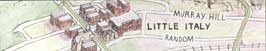
Needed improvements
The Circle-Heights Bike Network can be phased in over time.
Initially, a lot of simple and inexpensive things can be done with signage and paint markings on streets (such as bike symbols)signals that create the impression that the district is a place where bikes are an accepted part of the transportation system. In addition, fast routes would require attention to pavement maintenance and drain grates. Slow routes might require fewer stop signs, high pavements quality, traffic calming to discourage speeding motorists, and perhaps wayfinding signs that show distances to destinations.
Missing links
In addition to making the simple improvements mentioned above, it will be important to address a number of critical missing links in the bike network. These missing links could be filled by a combination of striped bike lanes, off-street trails, pavement widening, or intersection improvements. Problem areas include:
- The Circle-Heights district lacks safe and convenient north-south routes. Cottage Grove Drive could become a residential bike boulevard. Bike lanes should be evaluated for Lee Road, Coventry Road, and South Taylor Road. This is a critical need.
- The district has better east-west connections, but few are truly bike-friendly routes. Meadowbrook and Washington could become residential bike boulevards. Euclid Heights Boulevard, Cedar Road, and Mayfield Road should all be evaluated for bike lanes.
- Cedar Hill and University Circle needs a complete study of its own, given the large number of destinations and density of campus housing. One potential route starts at the intersection of Cedar Road, Euclid Heights Boulevard, and Overlook Road. It travels west on tiny Carlton Road, then descends the hill along an old carriage path to the intersection of Murray Hill and Adelbert roads. It continues through the CWRU quad, crossing Euclid Avenue at Adelbert and heading north between Thwing Center and the university library, across to Belflower, along the edge of the Cleveland Institute of Art parking lot, and across to Wade Oval, finally connecting to the Harrison Dillard Bikeway going north to the lakefront.
- To cross the Doan Brook ravine near Roxboro Road, a pedestrian/bicycle bridge could be built using the piers of an old bridge at the site.
- A path connecting Crest Road to Severance Town Center should be improved.
- Washington Boulevard is interrupted at South Taylor Road by a school. A connection could be re-established for bikes.
Back to top
EcoCity Cleveland
3500 Lorain Avenue, Suite 301, Cleveland OH 44113
Cuyahoga Bioregion
(216) 961-5020
www.ecocitycleveland.org
Copyright 2002-2003
|
|
Back to main Circle-Heights
|
|